

 Making communications among first responders interoperable
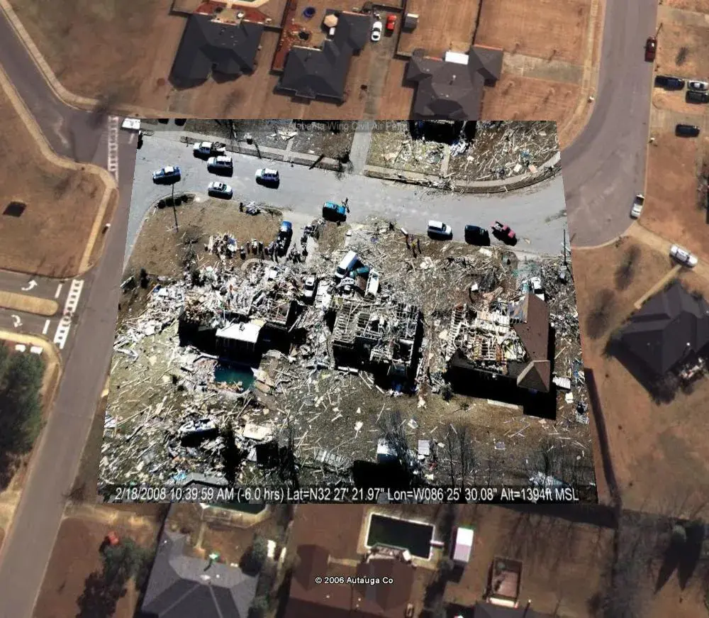
Natural disasters rarely color inside the lines. Like a toddler with his first box of crayons, they leave a mess all over the map—spilling across federal, state, and local lines. To clean up, different agencies and jurisdictions must come together and share what they know. But far too often, critical information goes unseen by those who need it most: our emergency responders.
In the past, there were incidents where deficiencies in communication caused problems for the emergency response community. In one case, while the National Guard was dispatching hundreds of trucks to a hurricane-ravaged area in the Southeast, drivers were unaware of a key road closure. In another instance, a neighboring state did not receive notification that planned evacuation routes were jammed with fleeing motorists. And at times, responders hurrying to aid residents outside their jurisdictions had limited information on what local resources were available.
Even though many authorities track incident management data, these records typically are walled off from one another by incompatible computer systems, proprietary technological platforms, or simply a culture of reluctance to share information.
Recognizing this urgent predicament, the Department of Homeland Security’s (DHS) Science and Technology Directorate (S&T) is working on a solution. Led by Dr. David Boyd, director of the Command, Control, and Interoperability Division (CCI), and patterned after the state of Alabama’s Virtual Alabama program, the project has been dubbed “Virtual USA” (vUSA). Its goal: to create a nationwide capability to share and standardize life-saving emergency data in real time.
A collaboration among CCI, first responders, and state governments, vUSA provides a 3-D platform of interactive maps that displays the location and status of critical assets—helicopter landing sites, evacuation routes, shelters, gas supplies, water lines, power grids, and everything in between. Whether you’re a county firefighter on the scene, a state-based EMT en route, or a federal FEMA official at your desk, the system equips responders at all levels with the same richly detailed data.
This coordination makes information sharing more comprehensive and decision making more informed, which is why vUSA was included in the recently announced White House Open Government Initiative, which emphasizes transparency, participation, and collaboration.
But one of vUSA’s most exciting attributes is platform agnosticism—the ability to integrate disparate data sources seamlessly (as long as the sources use the same standards). To a layman, this might not sound like a big deal. But to a first responder, who must contend with Alabama’s preference for Google Earth, Virginia’s need for ArcGIS, and X’s comfort with Y, interoperability constitutes a revolution.
Most importantly, the price is right. Typically, when an IT department is told it needs a new software system, what it hears is a request for a large amount of money.
Since February, Virtual USA has been operating as a pilot program in eight southeastern states: Alabama, Florida, Georgia, Louisiana, Mississippi, Tennessee, Texas, and Virginia. In September, CCI met with five northwestern states (Alaska, Idaho, Oregon, Idaho, Washington, and Wyoming), followed by talks with six northeastern states (Connecticut, Maine, Massachusetts, New Hampshire, New Jersey, and Vermont) earlier this month. The goal: to match the number of vUSA states with the number of stars on the American flag.
Yet, according to Director Boyd, standing up an interstate initiative rivals the difficulty of running it. “Just to socialize the concept of data-sharing—to get everyone communicating, to localize solutions—takes six months,” he says. But that’s not the end of the process. A plenary meeting for technical and governance matters comes next, after which a plan is designed. By this time, almost a year has passed.
Indeed, the chief challenge that vUSA faces isn’t the lack of data. It’s the lack of interoperable data. In order for data to be shared, you need to get people to share them. Put another way, mastering the software is the easy part. Getting human beings to collaborate is the hard part.
“Too many federal and state programs fall short of their potential because they’re driven from the top-down without buy-in at the local level,” Boyd continues. So in order to facilitate steadfast local participation, vUSA starts from a set of three principles:
1. You collect it; you own it. If, for example, a county funds and processes the collection of aerial photographs, then the county—not Washington—owns these data.
2. You own it; you control it. Decisions related to who the data is shared with—and when, how, and what to share—are at the discretion of the data’s owner.
3. You control it; you make the rules. Instead of having to adapt your data to accommodate others, you can continue to use your existing software and do business your way.
Shaped by this bottom-up foundation, Virtual USA is helping responders across the country to communicate better, to work together, play nice in the sandbox and share their crayons.
To request more information about this story, please e-mail st.snapshots@hq.dhs.gov.