

The Department of Homeland Security (DHS) Science and Technology Directorate (S&T) and Defence Research and Development Canada’s Centre for Security Science (DRDC CSS) as well as Public Safety Canada are preparing for the latest in a series of cross-border experiments. The Canada-U.S. Enhanced Resiliency Experiment (CAUSE) works to improve information-sharing and situational awareness between the two neighbors and is the latest move to build bilateral partnerships for emergency preparedness.
Following the successes of CAUSE III, which occurred in fall 2014, CAUSE IV aims to act as a catalyst for building relationships in support of the U.S.-Canadian Beyond the Border Action Plan. The objectives of the CAUSE series are to explore how to build a binational communications interoperability capability and to connect, test and demonstrate the emerging operational technologies available between the two countries. The CAUSE experiments enhance resilience in the border region by developing operational planning and processes and catalyzing dialogue to improve shared situational awareness and decision support for first responders and emergency managers on both sides of the border.
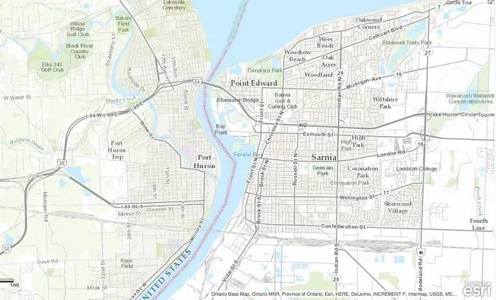
 The CAUSE IV experiment will take place between Port Huron, Michigan, and Sarnia, Ontario. The Blue Water Bridge, the second busiest crossing between the U.S. and Canada, will serve as the primary site of the emergency scenario. The experiment will consist of two crucial vignettes.
The first part will test the interoperability of paramedic and health services by fielding cross-border broadband and wireless networks that examine voice communications, electrocardiogram tracing, live video, patient records and overall situational awareness (such as vehicle tracking) over the course of the emergency scenario.
Program Manager Denis Gusty, with the DHS S&T’s First Responders Group, Office for Interoperability and Compatibility, spoke about the importance of the upcoming experiment. “Communications between paramedics and cross border ambulance dispatch centers and hospitals (known as patching) will be critical on the other side of the border.”
Gusty continued, “Another component of the experiment will be comparing and contrasting the various channels of public alerts and notifications to measure reach within the community. This information will be evaluated on data gleaned from social media to the Emergency Operations Centers (EOCs) across the border.”
 Source: Ontario Base Map, Ontario MNR, Province of Ontario, Esri, HERE, DeLorme, INCREMENT P, Intermap, USGS, METI/NASA, NGA, EPA, USDA, AAFC, NRCan
The second part of the experiment will pilot a binational capability to automate and link models that currently operate independently for alerts, situational awareness, citizen engagement and mutual aid planning efforts. These benchmarks will be part of an integrated and semi-automated process and capability enabling emergency managers to more precisely and efficiently work together.
The other component of the second part will include developing workflow process and algorithms for local alerting systems to trigger targeted public notifications via a variety of channels, including outdoor warning sirens, telephone, SMS-text message and social media. The alert messages will include pertinent public safety information to expand situational awareness for the public and local, state, provincial, non-governmental and federal partners. Building on this effort, digital volunteers and 211 dispatch centers will assist in developing an automated damage assessment triage-model to help emergency managers prioritize where to send teams into the field. Leveraging this information and a joint resource planning process, local emergency managers will make a cross-border request for assistance requiring state-provincial cooperation.
Philip Dawe, acting section head of Multi-Agency Crisis Management with DRDC CSS, explained how the experiment will build upon the lessons learned from CAUSE III. “Developing a concept of operations around various methods of notifying the public during emergencies, as well as testing innovative emergency communications technologies with paramedics as they cross the border, will help both countries in their emergency planning.”
The lessons learned from CAUSE III are also vital with regards to furthering knowledge on public alerting and the use of digital volunteers to leverage social media content.
CAUSE IV is scheduled to occur April 26-28, 2016. More information on the training, interviews and cross-border technology and tools will be available in the coming months.
Last Updated: 01/12/2023