

 in Camp Shelby, Mississippi.") Drones buzz like bees, hover like hummingbirds, and accelerate like race cars. Besides being used for play, drones, properly known as unmanned aircraft systems (UAS), have quickly become vital pieces of technology for both private and public organizations. First responder organizations rely more and more on them to enhance their response capabilities and better execute their missions. But how can first responders be sure the drones they are buying meet their specific mission needs?
Drones buzz like bees, hover like hummingbirds, and accelerate like race cars. Besides being used for play, drones, properly known as unmanned aircraft systems (UAS), have quickly become vital pieces of technology for both private and public organizations. First responder organizations rely more and more on them to enhance their response capabilities and better execute their missions. But how can first responders be sure the drones they are buying meet their specific mission needs?
The Department of Homeland Security (DHS) Science and Technology Directorate (S&T) can help.
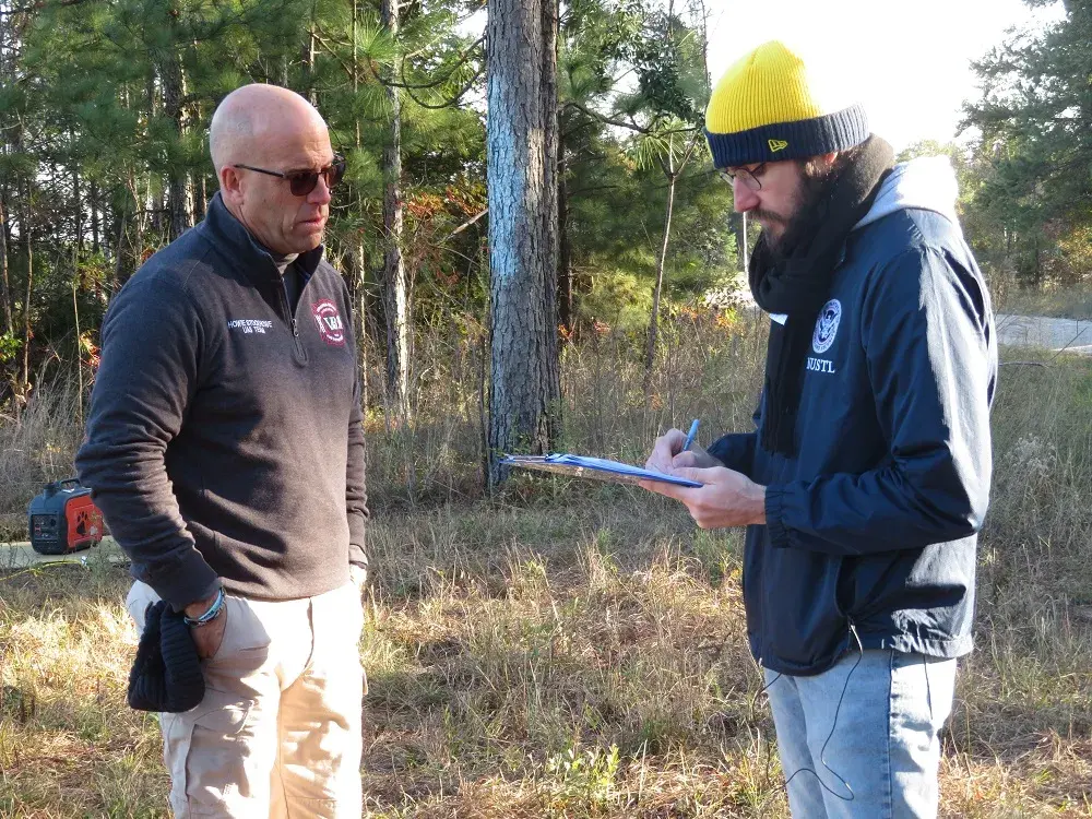
In November 2019, S&T’s National Urban Security Technology Laboratory (NUSTL) assessed small, commercially available drones for priority needs of first responders through its First Responder Robotic Operations System Test (FRROST) program. The needs were identified by the S&T First Responder Resource Group (FRRG), a volunteer working group of experienced emergency response and preparedness professionals from across the U.S. who guide research and development efforts. The assessment was performed under realistic field conditions at Camp Shelby Joint Forces Training Center in Mississippi.
“We are focused on the first responder community – fire, police, and emergency management departments – and we are assessing small UAS,” said Cecilia Murtagh, FRROST Project Manager. “They are much cheaper than manned aircraft, which makes them an ideal tool for response agencies.”
Background
S&T initiated the FRROST program in 2018 to help the first responder community evaluate drones in real-world field conditions under simulated scenarios to inform their purchases. FRROST is modeled after S&T’s System Assessment and Validation for Emergency Responders (SAVER) Program, managed by NUSTL. It assists emergency responders in making procurement decisions by producing reports based on objective assessments and validations of commercially available technology. FRROST focuses on drone technology and uses assessment methods developed by the National Institute of Standards and Technology (NIST).
In June 2018, a focus group of first responders, experienced in piloting drones for different missions, convened to provide evaluation criteria for the FRROST assessment. The focus group selected several drones to be tested and evaluated in realistic field conditions.
Becoming the ‘right hand’ of first responder organizations
 Small drones offer tremendous potential for emergency response missions. Thanks to recent technology advances, they have become more effective, more affordable and easier to fly. They can not only keep responders safer, but also provide opportunities for missions impossible for manned aircraft, such as exploring inside buildings and tunnels.
“Drones are a force multiplier for first responders,” said Murtagh. “It gives them eyes on a situation quickly with generally less manpower; for example, you could fly a drone over diverse terrain or wide areas and try to find a lost hiker, which would be labor intensive for field teams.”
Law enforcement responders use drones for tactical operations, building searches, traffic crash investigation, pursuit, and more. For example, the Plano, Texas Police Department used a drone to look for an armed suspect hidden in an apartment complex.
“The subject was actually firing rounds out of the apartment, so we couldn't get close enough to look in,” said Lieutenant Glenn Cavin of the Plano Police Department. “The UAS was able to look through the window and provide intelligence.”
After floods, emergency managers use drones to survey actual damage, so they send help where it is actually needed without risking responders’ lives.
“We have launched our drone to find a missing older adult,” said Randy Frank, Director of Marion County, Kansas Emergency Management. Small counties like Marion use the same drones for multiple missions. “Drone use is only limited to your imagination.”
Large counties like Orange County, California, need different drones for their various terrains, including metro city, wildland-urban boundary, harbors and more.
 “During a brush fire, a drone can map out where the hot spots are, thus helping the firefighters to put that hot area out,” said Frank Granados, Firefighter Paramedic at the Orange County Fire Authority, CA.
First responders assessed drones at Camp Shelby
In November 2019, nine first responder drone pilots from across the U.S., some of whom are quoted in this article, assessed four small drones in fields and mock urban settings at Camp Shelby. The drones weighed between 1.9 and 13.5 pounds. The pilots, with law enforcement, firefighting and emergency management backgrounds, participated in three different search and rescue scenarios: lost hiker (in an isolated field), post-flood disaster (in the urban setting and an adjacent field) and a twilight scenario (in the urban setting). The drones demonstrated different capabilities and participants provided feedback to NUSTL after taking turns flying them. NUSTL coordinated with NIST for this testing event, using a test course that NIST developed for drone assessment and pilot training and testing.
“All participants are getting an opportunity to run the drones through those standard test lanes to see how they match up against what they would like to see in a mission ready, small unmanned aerial system,” said Captain Tom Haus of the Los Angeles Fire Department, who assisted NIST with FRROST’s standard testing and scenarios.
 Wooden stands stood in a wide field next to the urban setting at Camp Shelby. Clusters of white two-gallon buckets like giant bell-shaped blossoms adorned the stands. Other clusters were attached to windows, roofs, and even a car. Inside each bucket on the bottom was a sticker with a letter surrounded by a circle. Such stickers could be seen on other parts of the buckets and poles. The drones had to hover over each bucket, like honeybees over a flower, and take accurate pictures.
“These visual acuity tests, just like the eye charts at the eye doctor, are designed to allow the operator to align his/her small unmanned aerial system with that bucket” said Haus. “If you are not aligned, the bucket itself keeps you from seeing into the bottom.”
Participants assessed how well the drones could be stabilized, how easily they could be flown, and how well their payloads functioned. Payloads included 30x zoom cameras for distant visualization and thermal cameras for twilight and night.
During the twilight testing, drones demonstrated their thermal imaging cameras and participants watched on a monitor what the drone was ‘seeing.’ One of the pilots moved the drone vertically, hovered it over the car, a roof and in front of a window, all with clusters of buckets. This simulated how a drone could be operated to look for survivors after an emergency or disaster, such as a hurricane.
 FRROST took place over four days, with a different drone assessed each day. A large drone with a 42-megapixel camera and an infrared camera was tested during the last day. It was designed for professional inspection and surveying of bridges and other areas. The first responder evaluators determined that it could be paired together with a smaller, faster drone. In this scenario, the evaluators used the large drone for overall incident awareness and then used a smaller drone for closer inspection.
Future outlook
The feedback provided by participants in the FRROST event will be documented in a final assessment report and shared nationally with the first responder community. NUSTL’s report will provide unbiased results that can help first responder organizations with their procurement decisions.
Moving forward, another S&T project called Joint Unmanned Systems Testing in Collaborative Environment, or JUSTICE, assesses drones and sensors for the Homeland Security Enterprise. JUSTICE is managed by the S&T Air Based Technologies Program and a team of experts from the Mississippi State University Raspet Flight Research Laboratory.
“Putting the drone in your hand, running it through its paces, seeing how it performs in a real scenario helps me determine if that's going to fit our mission and save us money,” said D.J. Smith, Technical Surveillance Agent with the Virginia State Police. “That’s critical for us.”