

The U.S. Department of Homeland Security (DHS) Science and Technology Directorate’s (S&T) First Responders Group (FRG) relies on experienced emergency response and preparedness professionals to guide its research and development efforts. The First Responder Resource Group (FRRG) fills that role. An all-volunteer working group, the FRRG helps S&T maintain focus on the top-priority needs of responders in the field. This series highlights several FRRG members, offering a glimpse into their daily responsibilities, as well as their ongoing support of S&T technology development.
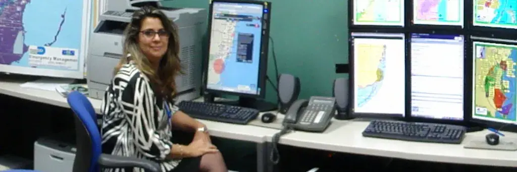
 Meet Soheila Ajabshir, senior geographic information systems (GIS) analyst and programmer for the Miami-Dade County (Florida) Information Technology Department. An expert in disaster response and GIS — she holds a Florida Professional Emergency Managers Certificate and a GIS Professional Certificate — Ajabshir has worked for several county and municipal governments (including nearly 20 years with Miami-Dade County) as a systems analyst, GIS manager, emergency manager and urban planner. In addition to her daily duties and FRRG membership, Ajabshir is also a member of the National Information Sharing Consortium and the Federal Emergency Management Agency All-Hazards Incident Management Team.
Mapping tools are essential to crisis managers and emergency responders, and GIS systems can provide emergency response teams with rapid access to a more comprehensive tactical picture, which helps reduce response times and increase operational efficiency. GIS systems often include the ability to link spatial data (such as a fire hydrant) to a specific location on a map, incorporate multiple data layers (e.g., roads, hospitals and schools), and feature a number of tools for compiling, querying and presenting data in a dynamic way. Ajabshir’s duties range from managing the day-to-day GIS operations for Miami-Dade County to maintaining the GIS systems that enable the Emergency Operations Center (EOC) to perform effectively, train staff and participate in EOC activations for large-scale events, natural disasters and more. “I love planning, and GIS is a great visual tool for problem solving,” she said. “Additionally, emergency management requires very crucial planning skills and knowledge to analyze data and use it to lessen the effects of disasters.”
"My job is about making decisions on how to best use technology to utilize and share information, save
lives and properties before, during and after disasters, and to mitigate against future emergencies.”
One thing Ajabshir has learned over the course of her career is that “collaboration and communication are key to resolving day-to-day or emergency activation issues in the EOC.” She continued, “It is very critical to communicate everything pre-storm, because when the storm hits, it is almost impossible to call or contact anyone. Planning for and predicting as much as possible in advance of emergencies leaves responders available and prepared to help the public and other response agencies.”
As Miami prepared to host Super Bowl XLIV, Ajabshir and her colleagues began preparing their GIS tools in early 2010 for the event. The 2010 Haiti Earthquake occurred on January 12, and it immediately became clear aid was needed. Miami has one of the largest Haitian populations in the U. S., and the Miami-Dade County GIS department became a vital point for response and communications. Ajabshir’s pre-Super Bowl GIS work with city police and other departments was quickly switched over to support relief efforts. She and her staff used their GIS tools to track information on people flying from Haiti to be transferred to Miami hospitals, monitor donations sent to Haiti from the U.S., and identify large groups of Haitian residents living in Miami-Dade County to establish disaster assistance centers where they would be most relevant for concerned family and relatives. Ajabshir has contributed articles to GIS publications, given speeches and presentations on the subject and received several awards and recognition for her work. In 2009, she received the first-ever Florida Emergency Management Innovator of the Year Award for her achievements and innovative practices in making communities safer, stronger and better prepared for emergency or disaster situations — an accomplishment for which she is particularly proud. More recently, she was honored with the 2014 Public Technology Institute GIS Vision Award, presented to outstanding state and local government GIS champions.
She joined the FRRG in 2010 on the recommendation of Miami-Dade Emergency Management Director Curtis Sommerhoff. Since then, she has attended annual FRRG meetings and assisted FRG with developing requirements and roadmaps for future technology development, specifically providing feedback related to the use of sensors for increased situational awareness and text-to-911 for limited English proficiency.
“My main expertise is in GIS and how visualization and analyzing data based on location can be utilized in first responders’ devices. There should be a platform that transmits and receives multimedia data between the incident and responders. The multi-media can be text, video streaming, sensor reading, social media data, current weather conditions, etc., that is available on a map and on a mobile device.”
At the recent 2015 FRRG Meeting, Ajabshir provided additional feedback as part of the Cyber, Decision-Making Support and Incident Management working group. The group discussed several topics relating to the ability to incorporate information from multiple and non-traditional sources [e.g., crowdsourcing and social media) into incident command and operations. “I enjoyed participating in this year’s FRRG meeting and with my working group. I’m excited to see what comes out next and how I can continue to contribute,” she said.
Check back soon for additional FRRG member spotlights. For more information on how to become a member of the FRRG, contact first.responder@hq.dhs.gov.